89 BAXTER RD
Owner Information
KNIGHT, FRANK J & CARLY A
89 BAXTER ROAD
WILLIAMSTOWN, MA 01267


Property Details
89 BAXTER RD is classified as a Single Family Residential (Cape-cod).
The primary structure on this property was built in 1950. There are 2,886ft2 of built area within this property. There is 2,886ft2 of residential/living space within this property. This property is listed as having 7 rooms.
89 BAXTER RD is valued at $487,100. The land is valued at $152,200 and the structures are valued at $334,900.
This property is in Zone GR. Confirm with local Zoning Board authorities to ensure there are no overlays or other easements on this property.
The most recent deed for 89 BAXTER RD is recorded at the local registrar in Book 1665, Page 406. 89 BAXTER RD was last sold on Monday, September 24, 2018 for $450,000.
Assessment data from fiscal year 2022.
Flood Data
According to the FEMA National Flood Hazard Layer, this property does not appear to be in a flood zone. It may also be in an area not yet reviewed. Nonetheless, confirm this information prior to taking any action.
To view the flood hazards around this property, create a FEMA "Firmette" Map of the area around 89 BAXTER RD.
Broadband Internet Providers
| Provider | Type | Bandwidth (mbps) | |
|---|---|---|---|
| Viasat Inc | Satellite | 35 | 3 |
| VSAT Systems, LLC. | Satellite | 2 | 1 |
| HughesNet | Satellite | 25 | 3 |
| GCI Communication Corp. | Satellite | 0 | 0 |
| Charter Communications Inc | Cable | 940 | 35 |
| Verizon New England Inc. | DSL | 10 | 1 |
Broadband service provider data from December 2020.
Adjacent Properties
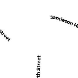
- 91 BAXTER RD
Single Family Residential owned by MASON, R CLINTON & - 58 JAMIESON HGTS
Single Family Residential owned by KUTTNER KENNETH N TRUSTEE - 62 JAMIESON HGTS
Single Family Residential owned by COCHRAN, ERIC L & STACY S - 71 BAXTER RD
Single Family Residential owned by DUNN, SUSAN I - 233 PARK ST
Single Family Residential owned by COCHRAN, ERIC L & STACY S